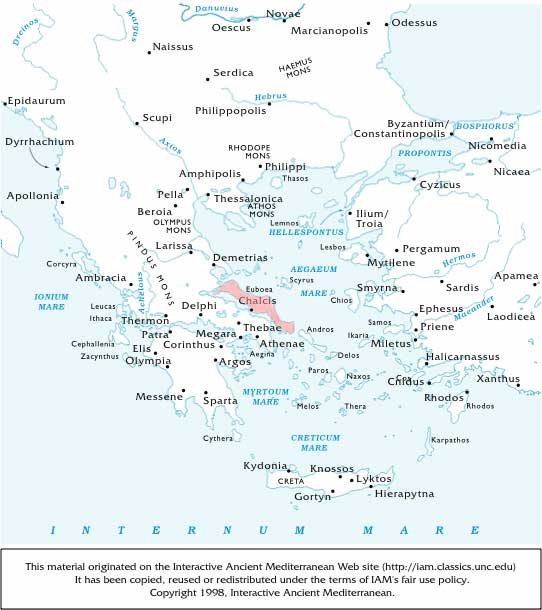
The largest island of the Aegaean Sea, lying along the coasts of Attica, Boeotia, and the southern part of Thessaly, from which countries it is separated by the Euboean Sea, called the Euripus in its narrowest part. Its early name was Macris. Euboea is about ninety miles in length; its extreme breadth is thirty miles, but in the narrowest part it is only four miles across. Throughout the length of the island runs a lofty range of mountains, which rise in one part as high as 7266 feet above the sea. It contains, nevertheless, many fertile plains, and was celebrated in antiquity for the excellence of its pasturage and corn-fields. According to the ancients it was once united to Boeotia, from which it was separated by an earthquake. In Homer ( Il.ii. 536) the inhabitants are called Abantes, and are represented as taking part in the expedition against Troy. In the northern part of Euboea dwelt the Histiaei, from whom that part of the island was called Histiaea; below these were the Ellopii, who gave the name of Ellopia to the district, extending as far as Aegae and Cerinthus; and in the south were the Dryopes. The centre of the island was inhabited chiefly by Ionians. It was in this part of Euboea that the Athenians planted the colonies of Chalcis and Eretria, which were the two most important cities in the island.After the Persian Wars Euboea became subject to the Athenians, who attached much importance to its possession; and consequently Pericles made great exertions to subdue it, when it revolted in B.C. 445. Under the Romans Euboea formed part of the province of Achaea. See Bursian, Topogr. von Euboia (1859). (Harpers Dictionary of Classical Antiquities, 1898)
* * *Island, the largest in Greece, after Crete. In the Aegean Sea, it forms with the island of Skyros to the northwest, the nomós (department) of Euboea, whose capital is Chalcis. Recognized geographically as part of the Greek mainland, which it almost touches at Chalcis, it lies along the coasts of the nomói of Attica, Boeotia, Phthiotis, and Magnesia. It is separated from the mainland by the North Gulf of Euboea and South Gulf of Euboea. It is about 110 miles (180 km) northwest-southeast, from 4 to 30 miles in breadth, and 1,411 square miles (3,655 square km) in area. The island is distinctly a prolongation of the Thessaly massif. Its principal ranges are separated by fertile lowlands.
The highest peaks in the north are Xirón Mountain (3,251 feet [991 metres]) and Teléthrion Mountain (3,182 feet [970 metres]). From Teléthrion the range trends eastward to the coast. In the centre of the island rises Dhírfis Mountain (5,715 feet [1,742 metres]), while in the south Ókhi Mountain reaches 4,587 feet (1,398 metres). The east coast is rocky and harbourless; in ancient times the main traffic from the north Aegean to Athens used the inshore channels because of the hazards of Cape Kafirévs on the southeast coast. Euboea has few streams, though south of Chalcis flows the Lílas River, the fertile plain of which in antiquity was a horse-breeding region that was bitterly contested by the rival cities of Chalcis and Eretria (Erétria).
The earliest inhabitants were the Abantes, who brought a Bronze Age culture from central Greece. In classical literature the island had a number of names, including Macris, Doliche, Abantis, and Hellopia, the last derived from the Hellopes, who occupied the north. The centre was occupied by the Ionians and the south by the Dryopes. The Ionians excelled at navigating the sea and traded in swords; Ionian Chalcis led the colonizing movement to Italy and Sicily, while Eretria, just south of Chalcis, about 750-700 BC led a large-scale colonization of the Thracian peninsula, later known as Chalcidice. Eretrians were the first to colonize Corfu, but on the arrival of the Corinthians (c. 734 BC) they retired to the Albanian coast. The alphabet of Chalcis and the local country tribal name of Graecus were eventually adopted by the Romans and western Europe.
Euboea's prosperity was checked by several decades of war, beginning about 700 BC, between Chalcis and Eretria. When the Euboeans lost their former trade advantages on the mainland, they were forced into an alliance with Boeotia and Sparta against Athens. In 506 Athenians captured Chalcis and settled the Lelantine Plain with their own citizens. In 490 the Persian king Darius I the Great subjugated Carystus (modern Káristos) in the south and destroyed Eretria. During the counteroffensive Euboea joined the Delian League and helped to win a great naval victory over the Persians (480). The island soon fell to Athenian imperialism, against which Euboea revolted in 446 and 411, the latter during the Peloponnesian War. A league of Euboean states formed during the second half of the 4th century BC had a long but interrupted existence. Under Roman domination Chalcis prospered. At the end of the 14th century AD, Venice won complete control of the island, but in 1470 they lost it to the Turks, who held it until it became a part of Greece in 1830.
The mountains of Euboea still have good pasture for sheep and cattle, and the name may be derived from euboia, "rich in cattle." Both forests and pastures, however, were devastated badly under the Turks by poor land-use practices. In antiquity the mountains yielded iron and copper, the basis of Chalcis' lucrative metalworking and export trade; now magnesite and nickel are exported. Lignite is mined at K&iaacute;mi and near Alivérion to fuel power stations. Káristos exports the green and white cipollino marble, which was much used for building in imperial Rome. The valleys produce grapes, olives, vegetables, fruit, and cereals. There is some industry, and the population is varied: the south, much like Andros Island to the southeast, is occupied by Albanians, and a Vlach element lives in the hill country. Pop. (1991) nomós, 209,132. (Encyclopædia Britannica Online.)